Equipment

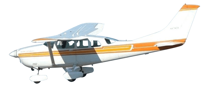
Cessna TU206 Stationair
AeroTech Mapping employs the venerable Cessna 206 as our photography platform. A staple of aerial survey fleets worldwide, the turbocharged Stationair is a high-performance aircraft capable of hauling heavy loads over long distances. The high wing provides excellent visibility and legendary stability for survey operations while the 310 horsepower Teledyne Continental power plant keeps us smoothly aloft.

Precision HawkEye Mark III UAV
Our fixed-wing UAV solution that is flexible, rugged, and reliable. Drones provide another alternative for a variety of situations.

Applanix Position and Orientation System (POS)
Applanix systems use Direct Geofencing to fly projects more efficiently with less sidelap, greatly reducing costs and environmental impact.

Vexcel Ultracam Falcon Mark 2 Digital Camera
Reliable high resolution digital aerial camera system equipped with UltraNav 510 and Applanix POSPac Mobile Mapping Suite.

DJI Phantom 4 UAV
DJI Phantom 4 UAV: Made with revolutionary materials, and designed with enhanced agility, the Phantom is flexible enough to meet different flying demands.

Seafloor HyDrone
Inspection/ survey of mines, sewage treatment plants, contaminated lakes, and rivers.

Mobile LiDAR Scanner, Alpha 3D Mobile Mapper
Laser scanner system for mapping and surveying.

Teledyne Optec CM2000 LiDAR Sensor
With a true measuring rate of up to 2 million points per second, the Galaxy CM2000 delivers precise detail of fine corridor elements such as electric wires and conductors, distribution power poles, railway signs, cellular tower antennas, as well the ability to detect fine changes in the ground over time for pipeline monitoring.

Advanced Photogrammetric Software Systems
At ATM we use some of the most advanced photogrammetric software systems available to help us produce our maps. These include DAT/EM Summit Evolution Softcopy digital mapping systems, and editing stations equipped with AutoCAD and Microstation.

Trimble Inpho Aerotriangulation Software
Precisely transform aerial images into consistent and accurate point clouds and surface models, orthophoto mosaics and digitized 3D features.


